The ArcGIS Event Editor web app supports launching through the passing of URL parameters. The app can be launched to automatically do any combination of the following:
- Select a specific tab (Map, Edit, Review).
- Load a specific widget (for example, Add Linear Events).
- Populate a specific widget with route ID and measures.
- Navigate the map to a route.
- Set an attribute set.
- Set an enterprise geodatabase version.
- Navigate the map to a geographic extent.
Event Editor comes with a web page known as a launcher, which allows you to use the URL parameter settings to launch it. This feature can be used in conjunction with ArcGIS Workflow Manager (Classic) to launch Event Editor from a job step. This feature can also be used to create Windows desktop shortcuts to launch Event Editor.
The following steps describe how to use the launcher:
- In a browser, type http://<YourServerName>/<YourEventEditorFolderName>/launcher.html and press Enter, for example, http://testmachine1/EE/Launcher.html.
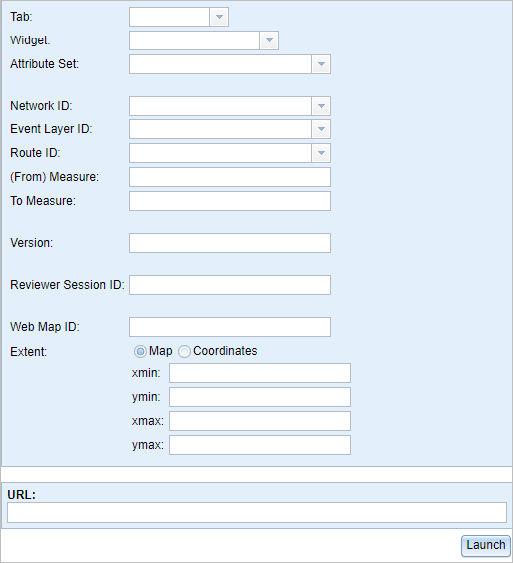
The Event Editor Launcher dialog box appears.

Remarque :
- The read-only URL field at the bottom displays the configuration choices you make.
- The URL launches the Event Editor with only the information you provided in the Launcher dialog box.
- The URL created on the Launcher dialog box can be used as an example to create custom URLs to launch Event Editor with Workflow Manager (Classic).
- All of the launcher fields are optional.
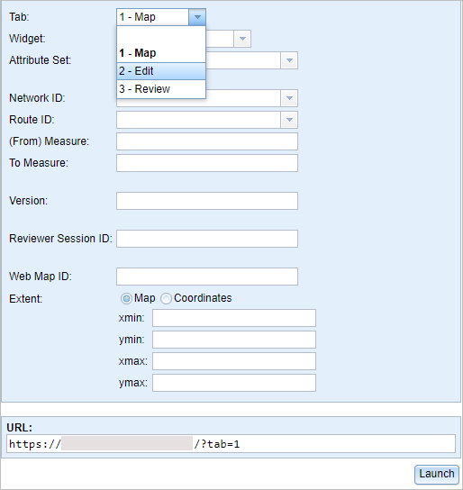
- Click the Tab drop-down arrow and choose 2 - Edit.


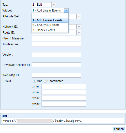
- In the Widget drop-down list, choose 1 - Add Linear Events.
- In the Network ID drop-down list, choose or type a valid network ID.
- In the Route ID drop-down list, choose a route ID or type a valid route ID.
- Type a (From) Measure value for the new event.
- Type a To Measure value for the new event.
- Type a Version name for the database.
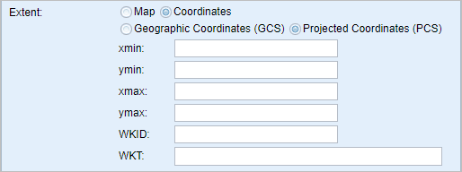
- Define a launch extent for the map using any of the following methods:
Remarque :
If you do not provide any extents, the map is zoomed to the selected route.
- Click the Map button and provide values in the xmin, ymin, xmax, and ymax text boxes to define an extent.
- Click the Coordinates and Geographic Coordinates (GCS) buttons and provide values in the xmin, ymin, xmax, and ymax text boxes to define an extent using geographic coordinates.
- Click the Coordinates and Geographic Coordinates (GCS) buttons and provide a Well-Known ID (WKID) value in the WKID text box.

The following geographic coordinates example defines an extent:
http://<your portal url>/apps/webappviewer/index.html?extent=-117.20,34.055,-117.19,34.06 - Click the Coordinates and Projected Coordinates (PCS) buttons and provide values in the xmin, ymin, xmax, and ymax text boxes.
- Click the Coordinates and Projected Coordinates (PCS) buttons and provide a Well-Known ID (WKID) value in the WKID text box.
- Click the Coordinates and Projected Coordinates (PCS) buttons and provide a Well-Known Text String (WKT) in the WKT text box.

The following projected coordinates example defines an extent using WKID:
http://<your portal url>/apps/webappviewer/index.html?extent=2446038.607175,-75063.151855,2446563.664748,-74704.315069,26941The following projected coordinates example defines an extent using WKT:
http://<your portal url>/apps/webappviewer/index.html?extent=2446038.607175,-75063.151855,2446563.664748,-74704.315069&wkt=PROJCS["NAD_1983_StatePlane_California_I_FIPS_0401",GEOGCS["GCS_North_American_1983",DATUM["D_North_American_1983",SPHEROID["GRS_1980",6378137.0,298.257222101]],PRIMEM["Greenwich",0.0],UNIT["Degree",0.0174532925199433]],PROJECTION["Lambert_Conformal_Conic"],PARAMETER["False_Easting",2000000.0],PARAMETER["False_Northing",500000.0],PARAMETER["Central_Meridian",-122.0],PARAMETER["Standard_Parallel_1",40.0],PARAMETER["Standard_Parallel_2",41.66666666666666],PARAMETER["Latitude_Of_Origin",39.33333333333334],UNIT["Meter",1.0]]
- Click Launch.A new browser window appears in the Event Editor. The Add Linear Events widget is opened with prepopulated values and zoomed to the route using a specific version of the database. The From Measure and To Measure values are located on the map.
Vous avez un commentaire à formuler concernant cette rubrique ?